|
 (English version,
Wikipedia copyright)
(English version,
Wikipedia copyright)
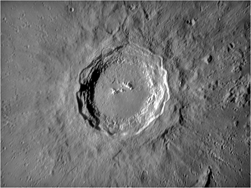
Copernicus
is a prominent lunar impact crater located on the eastern Oceanus
Procellarum. It visible with binoculars slightly northwest of the center of
the Moon's Earth-facing hemisphere. South of the crater is the Mare
Insularum, and to the south-south west is Reinhold crater. North of
Copernicus are the Montes Carpatus, which lies at the south edge of Mare
Imbrium. West of Copernicus is a group of dispersed lunar hills.
The crater
Copernicus is estimated to be about 800 million years old, the time marking
the start of the Copernican era in the Lunar geologic timescale. Due
to its relative youth, the crater has received very little erosion and it
remains sharp and well-defined.
The
circular rim has a discernable hexagonal form, with a terraced inner wall
and a 30-km wide, sloping rampart that descends nearly a kilometer to the
surrounding maria.
There are three distinct terraces visible, and arc-shaped landslides due to
slumping of the inner wall as the crater debris subsided.
Most likely
due to its recent formation, the crater floor has not been flooded by lava.
The terrain along the bottom is hilly in the southern half while the north
is relatively smooth. The central peaks consist of three isolated
mountainous rises climbing as high as 1.2 km above the floor. These peaks
are separated from each other by valleys, and they form a rough line along
an east-west axis.
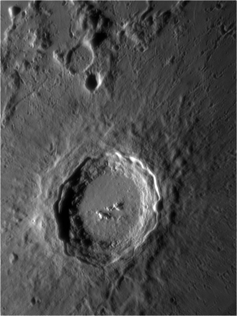
The crater
rays spread as far as 800 kilometers across the surrounding maria,
overlaying rays from the Aristarchus and Kepler craters. The rays are less
distinct than the long, linear rays about Tycho crater, instead forming a
nebulous pattern with plumy markings. In multiple locations the rays lay at
glancing angles, instead of forming a true radial dispersal. An extensive
pattern of smaller secondary craters can also be observed surrounding
Copernicus, a detail that was depicted in a map by Giovanni Cassini in 1680.
Some of these secondary craters form sinuous chains in the ejecta.
|