|
||||||
|
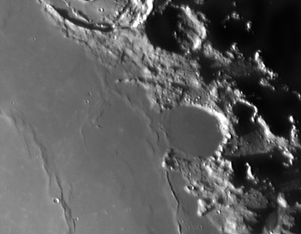
Le Monnier is the remnant of a lunar crater that has been partly innundated by lava flows. It is located on the east edge of Mare Serenitatis, and the west part of the rim is missing so that it now forms a large bay. To the north is the Chacornac crater. The interior of this formation is relatively flat and smooth, with no significant craterlets to mark the surface. The outer rim is battered, worn, and notched with past impacts. Only slight wrinkle-ridges now mark where the western rim once lay. The landing site of the Luna 21 space probe is located near the southern rim of Le Monnier. Lunokhod 2, a robotic roving vehicle deposited on the surface by Luna 21, covered a distance of 37 kilometers across the crater floor. It also surveyed the southern edge of the crater rim. |
| |||||


 Le Monnier
 (English version,